Adventure Review: Sailors on the Starless Sea
Dungeon Crawl Classics RPG. Level 0. My experience: Run 2x for public games.
A solid mod that doesn't live up to the hype.
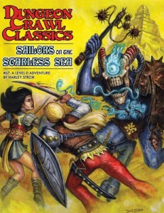
Sailors on the Starless Sea is maybe the most popular mod for Dungeon Crawl Classics. It was released when the game came out as a starter funnel and has such widespread acclaim that it got a hardcover edition. I'm reviewing this because I ran it a few times and it worked only ok for me.
First, an overview: this is a funnel where the PCs play several level 0s each. I love that format and the way it gets people used to running multiple guys. They're sent off to a ruined keep in the wilderness. Inside are beastmen, and there are also some delightfully creepy vine monsters. The PCs have to fight past the beastmen into the keep, descend into the underworld, cross a great lake, and then disrupt a massive ritual. It's a stellar synopsis, a classic plot that gets the PCs into the world.
I found the keep location the strongest. The PCs have a few different options to get in, then a chance to explore, learn some lore about the place, fight a few more beastmen. Then they've got one way to go--down. I think that's great in a funnel; keep the PCs moving and on track.
Below ground things required more work. First, there's this location that expands on the vine creatures called "The Summoning Pits". It's evocative and strange and probably great but it just doesn't fit into a 4 hour session. For a home game you can include it but I wouldn't at a con.
Then, there is crossing the sea. The PCs get a boat they summon and use to get across, and along the way they are attacked by a Leviathan. The Leviathan is brutally difficult, able to TPK the party if they don't either 1) burn luck on their damage rolls or 2) figure out an alternative. The mod has two; they can use some incense they found in the keep (which repels chaos creatures) or they can offer a deliberate sacrifice.
In my games, they didn't figure out the incense idea. It's just a lot to put together--they have to take incense from the box, use it on the creature up there, then make the connection that it should also affect the Leviathan, which is both much stronger and in a different area. Clever parties might but mine didn't. They also didn't land on the sacrifice idea--once they saw that the Leviathan started eating people, it didn't occur to them that a deliberate sacrifice would have a different effect.
So they ended up burning luck. In one case I had to coach them through it, because the group was new, and that was unsatisfying. "Ask the GM how to proceed."
The result of these encounters meant that only a couple of PCs got to the final ritual location, a ziggurat. Here, there are dozens of beastmen being whipped into a frenzy--it's clear at this point that the PCs are not going to be able to accomplish anything, in terms of combat or stealth.
My players decided to continue, sneaking up to disrupt the ritual anyway. It felt like they stepped out of the game to do so, knowing the adventure was at its climax.
I found this section difficult to run, because there were dozens of beastmen and several layers to the ziggurat. Abstracting worked but a lot of pieces. Through some clever play and suicidal actions, the PCs did disrupt things leading to a nice finish. But by the time it was over only one or two PCs lived.
Overall I found it too involved and just too difficult to be a good con game. If several players are new, running many level 0s is confusing. And, the module has some nontrivial puzzles which have to be solved for a successful conclusion. It is asking a lot for the players to learn to play, to play 4 characters, and to figure out the puzzles all at once. The lethality of the mod makes it a poor campaign starter because the players won't have enough left to form a level 1 party.
I think an experienced GM and a clever (and experienced) group of players could have a great time. But it isn't a great starter mod. For cons, I recommend Tower of the Black Pearl or Citadel of the Scarlet Minotaur or Frozen in Time. As a funnel, I liked Beneath the Well of Brass better.


